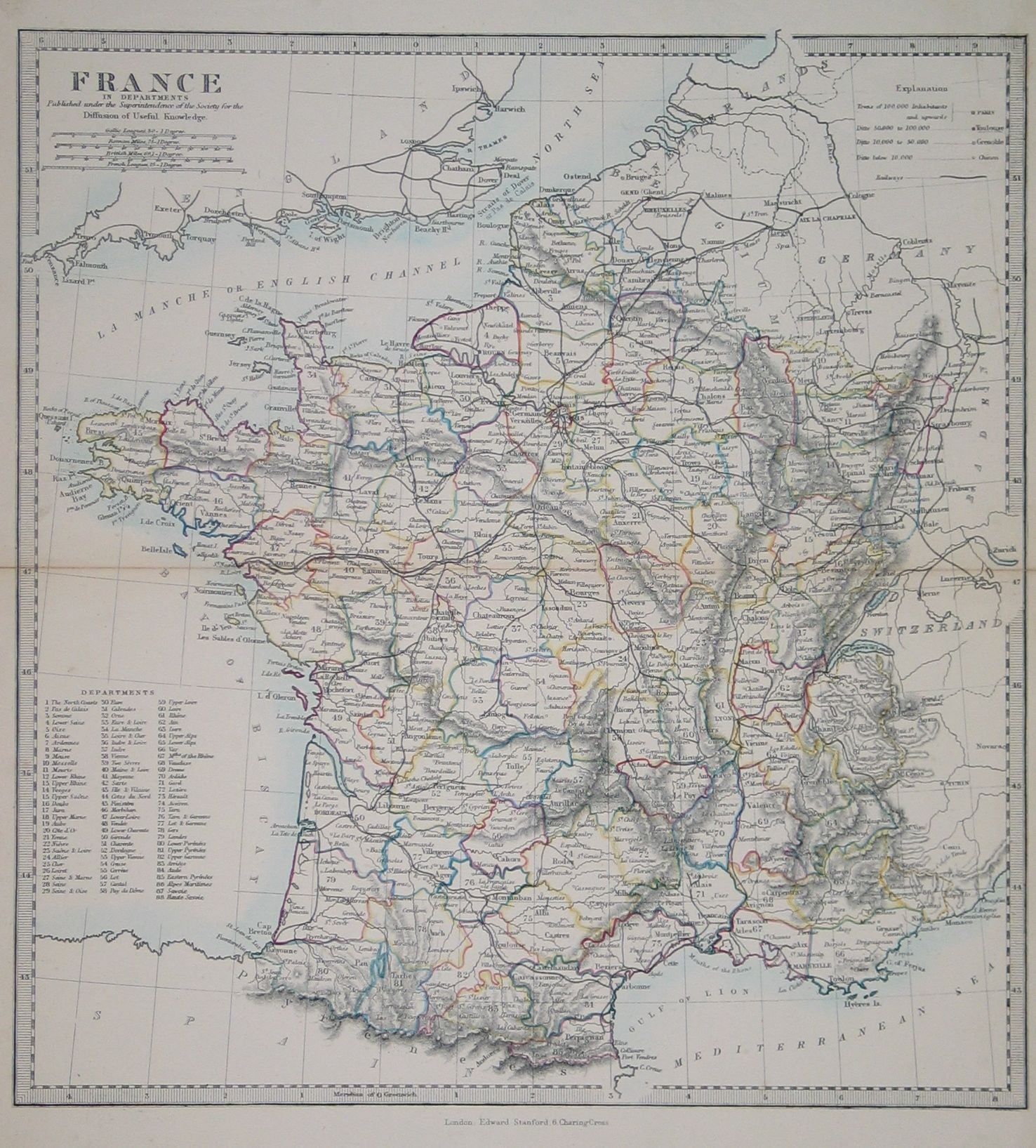
Detailed map showing cities, rivers, railways and with relief show by hachuring. Departments numbered with a key on LHS of map.
| Date | c.1850 |
|---|---|
| Dimensions (mm) | 325 x 346 |
| Place | 6, Charing Cross, London |
| Publisher | Edward Stanford. Published under the Superintendence of the Society for the Diffusion of Useful Knowledge |
| Condition | Very good. Centre fold. Vibrant hand colouring. |